Layout
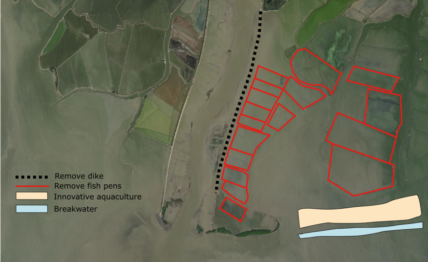
Figure above shows the layout of the Pampanga River east bank.
-
-
The first task will be to demolish the east bank dike. The main reason why the east bank is chosen is that the dike is already in an increasing deteriorating state, but the dike on the river’s west bank is in a relatively good condition and used to access a provincial tourist recreation attraction and thus more institutionally complex to remove, if at all.
-
-
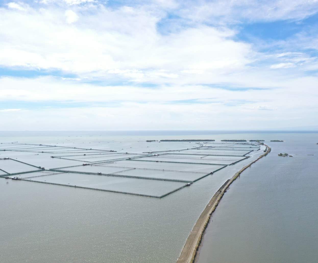
There are currently about 20 fish pens ( former fishpond operators) operating, as shown in the red line boxes. The LGU will need to check if they have a valid permit, if not, they can be relocated immediately. If they have a valid permit, a relocation/ compensation plan needs to be made.
-
The breakwater will be needed to kickstart and enhance the sediment trapping speed to recreate new foreshore/mudflats. This breakwater will need to be constructed taking into account hydraulic loads and the shape of the subsoil (soft soil). As much as possible, the breakwater will need to be built from materials available within the North Manila Bay delta system, such as dredged materials, bamboo/wood and revetment re-use.
-
Behind the breakwater (over time), the old fish pens locations will collect the sediment coming in from the Pampanga river (through the removed east bank dike). When this process has started, the pilot can be extended to the fishponds situated more north to restore the Mangrove belt.
-
As substantial portions of the river and its mudflats have been has been converted into fishponds, these need to be removed in certain areas and the owners compensated. Riverbank mudflat expansion in this area will also greatly benefit the very large number of migratory waterbirds of international importance present at the river most of the year
A. Removing east bank Pampanga River
The current maintenance state of the east bank is poor. The revetment is damaged severely, and various uncontrolled settlements have been observed.
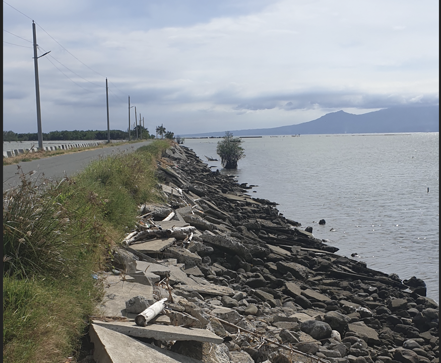
Pampanga river east bank looking south towards fish pens (left) current state of revetment (right)
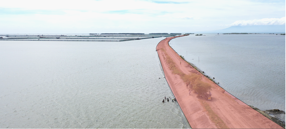
When removing the east bank, the concrete materials can be re-used as foundation or the breakwater construction.
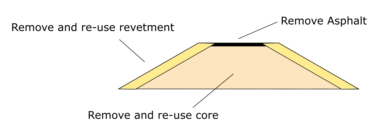
Schematic construction activities removing east bank Pampanga river
Prior to removal geotechnical and concrete material investigations should be done to confirm if the soil and other materials are fit for re-use (contamination). The removal/demolition of the dike can be executed by “ordinary” excavators which excavate and transfer the material into barges. The barges can be used to ship the material to the re-use location. The length of the dike to be removed is approximately 3500 meters.
Existing dike geometry assumptions
Parameters | Value | unit |
Crest witdh | 10 | [m] |
Slope | 2 | [1:x] |
Crest level | 3 | [m MSL] |
Toe level | -1 | [m MSL] |
Armour thickness | 0.3 | [m] |
Asphalt thickness | 0.3 | [m] |
Length dike | 3500 | [m] |
B. Relocate the fish pens
Approximately 20 fish pens (300 hectares) may need to be removed and/or relocated. and compensated. The LGU of Hagonoy will need to check current permits/consent in place for these fish pens to operate after which discussions on removal and relocation with the respective owners can start. Another option to research is to allow some fish pens to operate and monitor over time if there is any difference in siltation between operational and non-operational sites. This, however, may lead to “unwanted” siltation of operational fish pens.
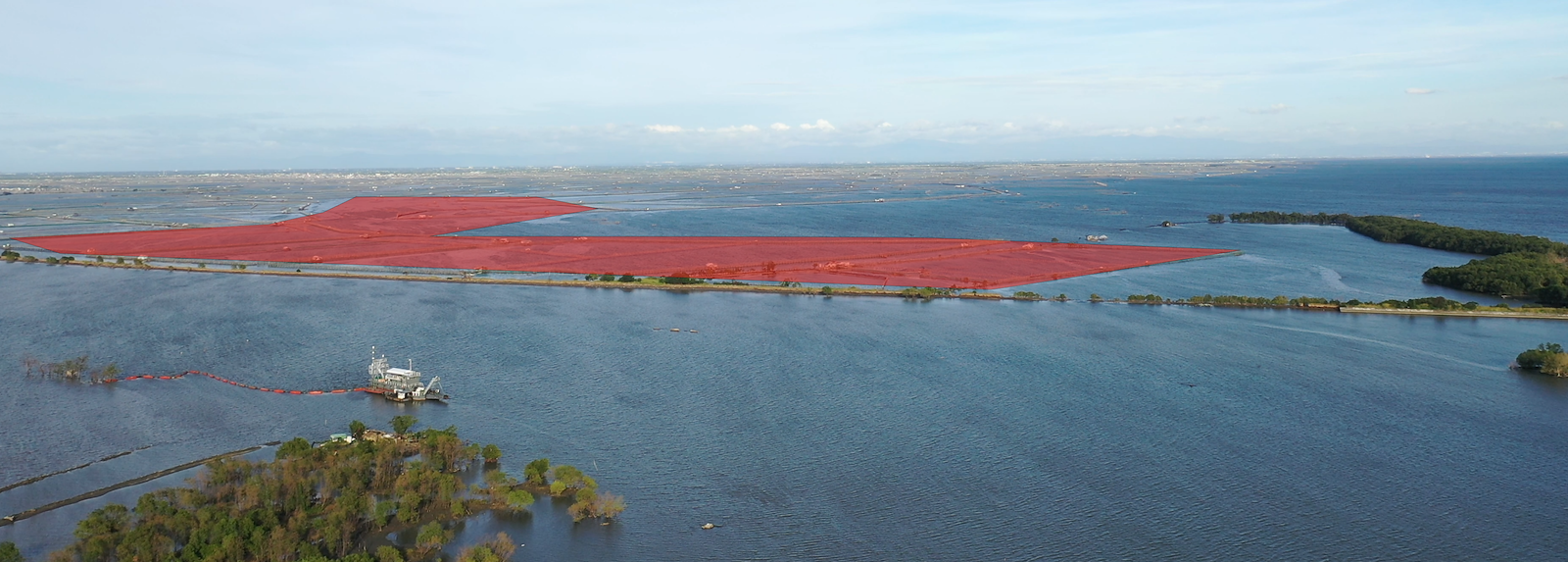
According to conversation had with local stakeholders about 50% of fishponds in the area are operational due the increased damages during flooding/typhoon conditions. The fish pen area is one such example.
C. Building an enhanced breakwater
For the breakwater to have a proper design life, the soft soil underneath the breakwater will need to be replaced with a more stiff material (sand) foundation. except in areas where former stone dikes still exists . This dredged material can be re-used on the north side of the breakwater to kick start the sedimentation process. If this is too expensive or no permits can be acquired for this type of construction, the breakwater can still be constructed. However, it will need regular maintenance after construction without foundation (every six months for the first five years, after that every two years) to compensate for settlement.
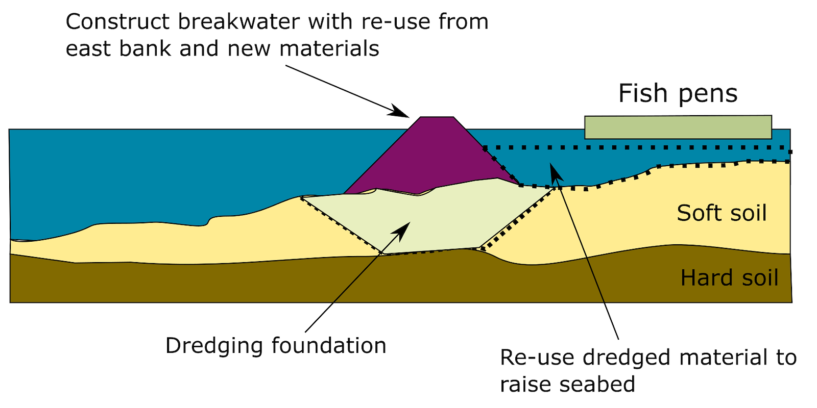
The breakwater itself can be constructed using material obtained from removing the east bank as core material. The revetments will need to be designed for the breakwater to withstand wave attacks during severe typhoon conditions (1/100 year return period event).
Breakwater parameters
Parameters | Value | unit |
Crest witdh | 2 | [m] |
Slope | 3 | [1:x] |
Crest level | 3 | [m MSL] |
Toe level | -2 | [m MSL] |
Armour thickness | 2 | [m] |
Length breakwater | 1500 | [m] |
Dredging depth | 8 | [m] |
Dredging width | 30 | [m] |
D. Aquaculture solutions/innovations
To compensate for the loss in livelihood due to removal of the fish pens and promote an alternate way of livelihood, shellfish reefs and hanging structures (mussels/oysters) are proposed to be placed behind the breakwater. It is understood that the net profit of fish pen livelihoods are higher than of shells production. Any further plans should incorporate a strategy on compensating fishpond/fishpen owners and focusing shellfish production as livelihood for the lowest income earners.
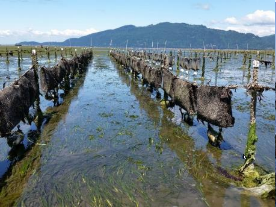
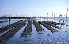
Oyster farming [64] and mussel farming [65]