Solutions
The interactive content below might not be fully accessible.
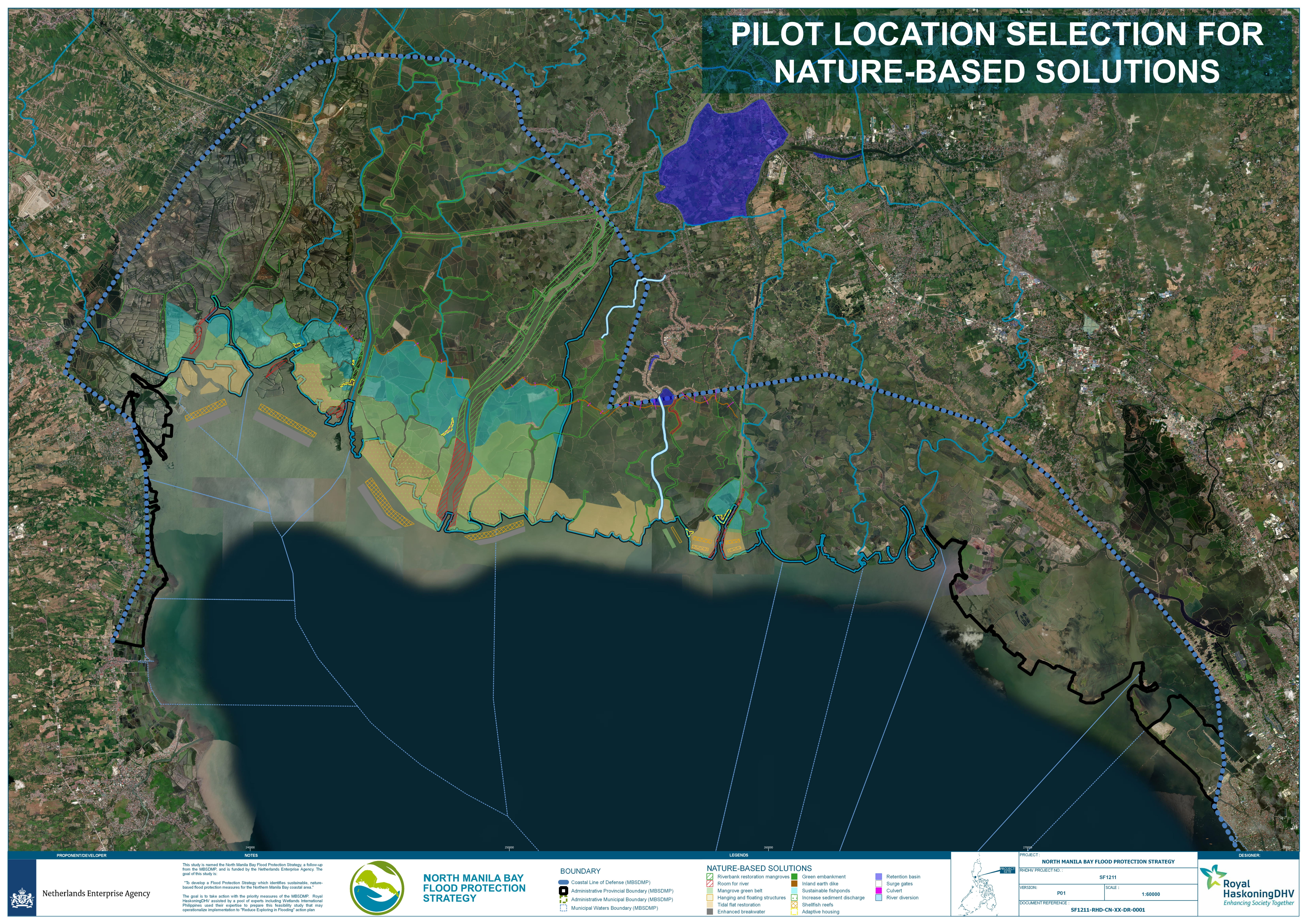
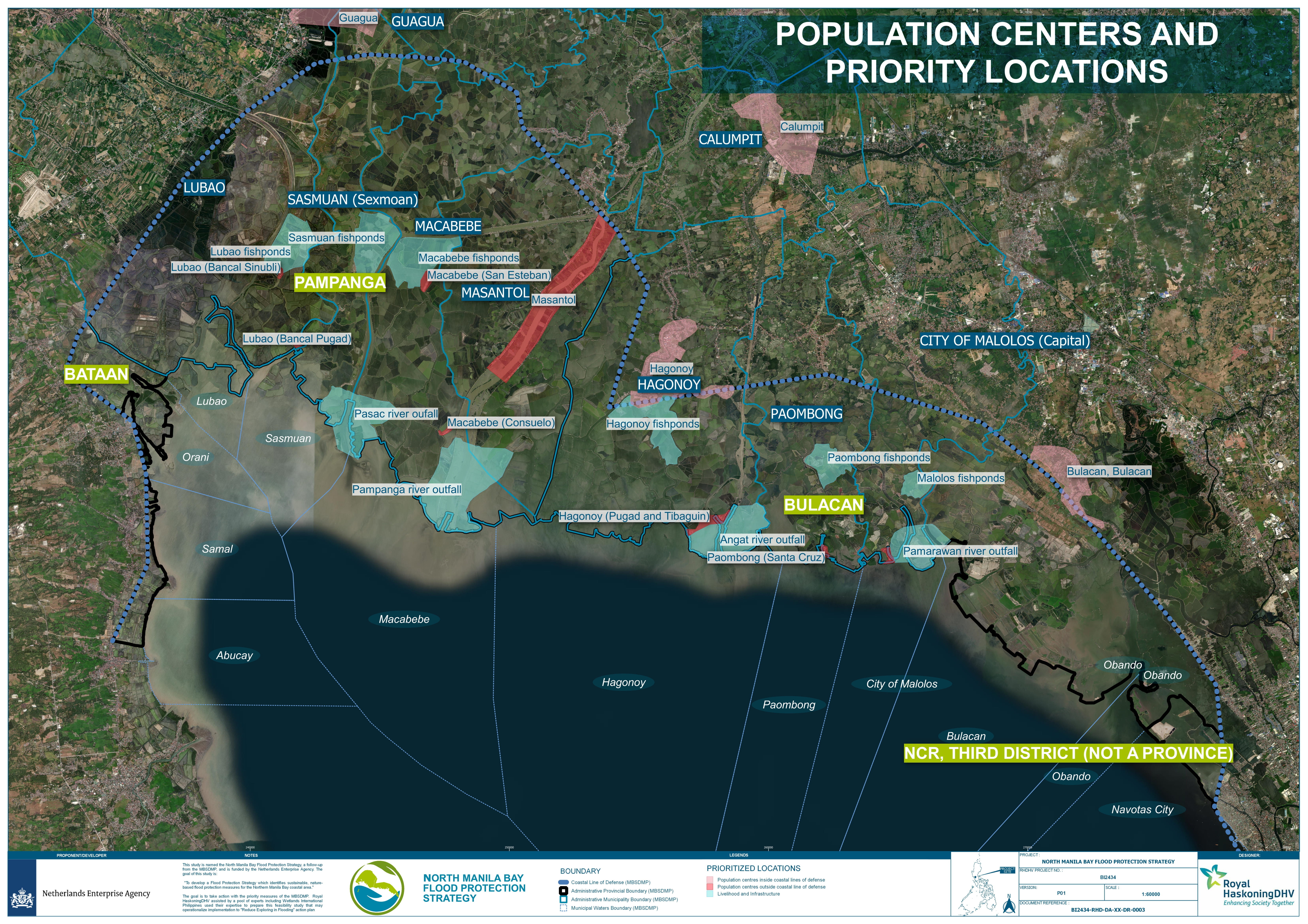
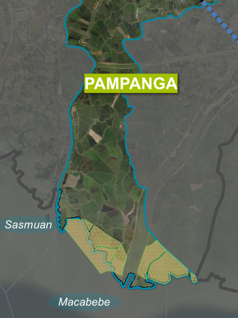
Appendix 6 shows a map of possible solutions that have been identified. The map aims to have a unified strategy across Bulacan and Pampanga. The strategy stays clear from implementing solutions near the New Manila International Airport and at known internationally critically habitats for migratory species including fish and waterbirds such as at the Pampanga River, outfall, and coastal mudflats in Sta Cruz, Paombong, and Pamarawan- Caliligawan, Malolos. For the airport area, it is expected that this area will be subject to various landscape changes in the coming years. The map also aims to unify various strategies/plans that have been developed or are being undertaken at the moment:
-
Manila Bay Sustainable Development Master Plan [1]
-
Building with Nature Asia Landscape proposition [7]
-
-
Wetlands Philippines Building with Nature Asia Landscape proposition (see Appendix 1)
-
-
Potential Measures to reduce Fluvial and Tidal Floods in the Pampanga Delta [63]
-
North Manila Bay Flood Protection Strategy (this report)
This North Manila Bay Flood Protection Strategy ties together the plans identified above. but not the draft Biodiversity Off-set Management Plan for New Manila International Airport, which include the same coastal and near-near coastal areas as this Strategy. It adds to these an extensive assessment of root causes, stakeholder requirements, and institutional setting. The Nature-based Solutions proposed in Section 8 and the location selection in Section 9 provide the basis for the proposed solutions for the flooding problem in North Manila Bay area.
Background on proposed solutions map
This section gives an explanation of the map added in Appendix 6.
Retention
To have a significant impact on the amount of flooding, the people in population centres need to deal with a month-to-month basis approach. Creating a retention area near Calumpit between the Pampanga and Angat rivers is a solution. The retention area will need to have enough size to “cap” the flood levels for at least 1/1 per year return period river discharge. The capacity required for this in terms of area and depth for the retention basin needs to be further researched. The social impact of a retention basin is significant. The people and businesses currently residing in the area need to be relocated or provided tools to adapt to a situation where they experience more flooding. Due to the complexity and the costs associated with this, a retention area will not be nominated as a pilot area.
River diversion
(Room for living space)
A significant (reduction) impact on the amount of flooding in Hagonoy (and other urban areas) can be achieved by creating a river diversion between Angat River and Pampanga River. However, the cumulative, environmental and social impacts needs to be assessed. This area between the Pampanga and Angat River is significantly less densely populated than the urban Hagonoy. The river diversion should incorporate wide flood plains to allow it to be “sold and funded” as a Nature-based Solution. The social impact(livelihood) is significant as a number of current fishponds will need to be converted.
An alternative solution is allowing for river run-off through lowering/removing fishponds in the area, which is proposed as a part of the study by Van ‘t Veld [21].
River widening
(Room for the river)
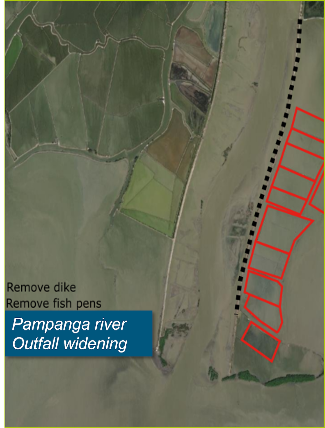
Recreating wider floodplains adjacent to the existing rivers is a solution to increase the rivers flow capacity and reduce the flood levels upstream. Currently, most of the original flood plains are either diked or converted to fishponds. Regulations on the expanding fishponds onat the flood plains should be enforced by the LGU or where no policy regulations are in place; regulatory Ordinances needs to be researched to allow for the flood plains to be issued.
Sediment trapping
Restoring the sediment balance to a situation ~100 years ago will allow for new sediment built-up along the shoreline. This sediment built-up will contribute to reduced coastal erosion and protect inland areas from wave attack and coastal surges. The protection from wave attack will also benefit the sediment's accretion speed, creating a cumulative effect. Additionally, the newly settled sediment will stimulate mangrove growth and contribute to mudflat restoration vital for livelihoods and biodiversity.
"Soft measures"

Soft measures are measures that do not require physical implementation. For the North Manila Bay area, the following measures are proposed
-
Focus on raising awareness and knowledge transfer of DPWH and other government agencies and LGUs and affected communities
-
Support LGUs when creating CLUP or other water management policies, this strategy combined with the Climate Responsive Integrated Master Plan for Pampanga River Basin [54], should be the input.
-
Include Nature-based Solutions tools in DWPH design guidelines and in DENR Mangrove Administrative Orders
-
Cancel sediment mining and dredging permits in the foreshore area
-
Giving more powers to ABB-BP
-
Free and prior consent relocation of informal settlers through incentives and other compensations
-
Re-use of dredged river sediment materials