Location selection
The location selection aims to pinpoint the areas most exposed to flood risks. A granulation of the wider North Manila Bay Delta area to identify specific locations at barangay levels is needed to acquire selection of proposed priority areas, for which Nature-based Solutions as flood protection are most applicable. This Section sets out the funnelling from the wider North Manila Bay area to local level in 6 steps.
Step 1: North Manila Bay
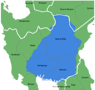
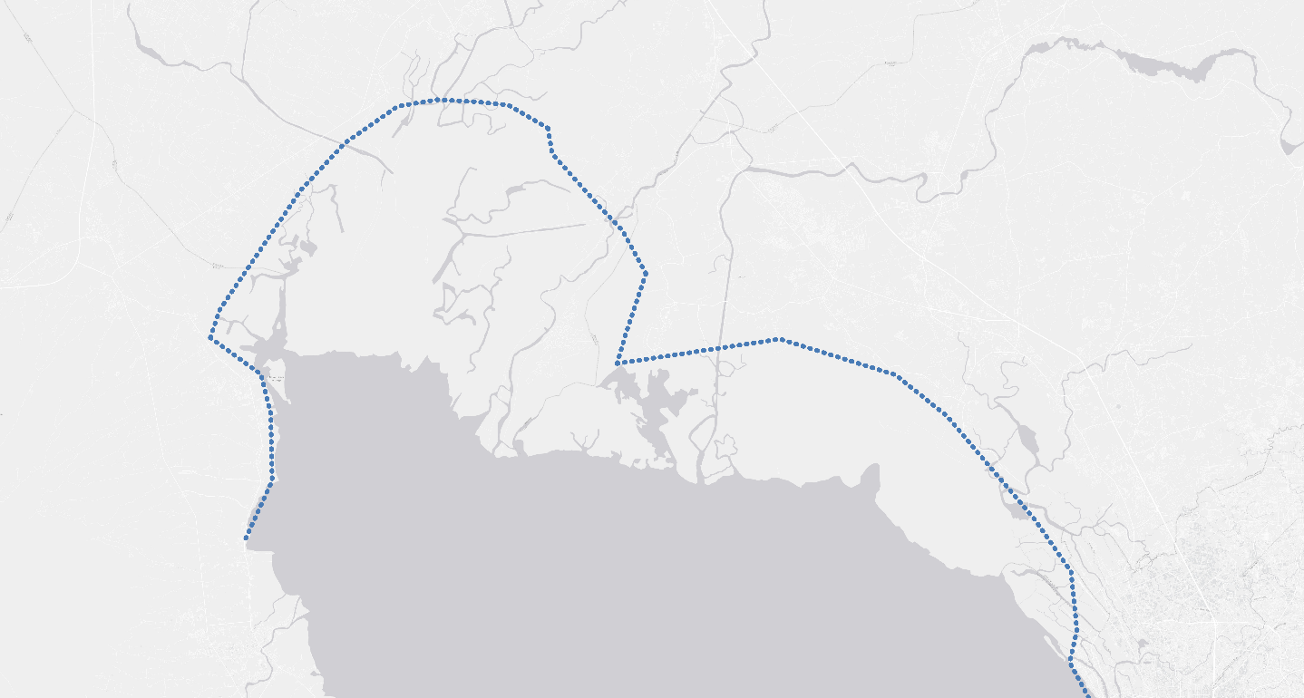
The “North of Manila Bay” as referenced to in this flood protection strategy can be described in its broadest sense as Pampanga River Delta and Angat River Delta which are part of the wider Pampanga River Basin. The Pampanga River Basin and Delta are shown in the figure below.
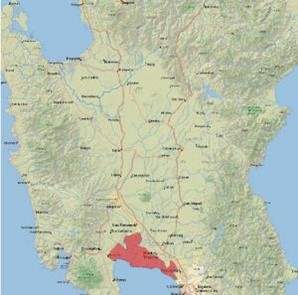
The focus area of this Flood Protection Strategy is coastal and coastal municipalities, and towns of Pampanga and Bulacan (see figure Location of Local Government Units included in the Flood Protection Strategy). The steps below describe how the granulation is being achieved.
Step 2: Coastal Line of Defence
The Manila Bay Sustainable Development Masterplan proposes a concept named the ‘Coastal Line of Defence’ (CLD) which is based on the Report on Manila Bay Considerations on Coastal Protection [22]. In summary, the CLD is to be the basis for distinguishing:
-
Areas that can be developed and protected (based on cost-benefit analysis);
-
Areas that are too costly to improve and protect in the long run - thus retreat is inevitable to ensure the long-term security of people exposed to flooding and avoid loss of investments in development and flood protection that are likely to be inundated in the future; and
-
Areas with a high potential to restore natural resources and habitats and to achieve goals related to habitat restoration and carbon emissions/storage.
As the scope of the North Manila Bay Flood Protection Strategy focuses on the coastal area of North Manila Bay, the philosophy regarding the Coastal Line of Defence is that, in line with [22], existing population centres that currently lie outside of the Coastal Line of Defence will need to be provided protection. The Coastal Line of Defence itself will need to provide protection for the population centres that lie more upstream in the delta. The North Manila Bay Flood Protection Strategy will focus on devising a strategy for the locations that:
-
Include towns and areas along the Coastal Line of Defence
-
Lie between the Coastal Line of Defence and the current coastline.
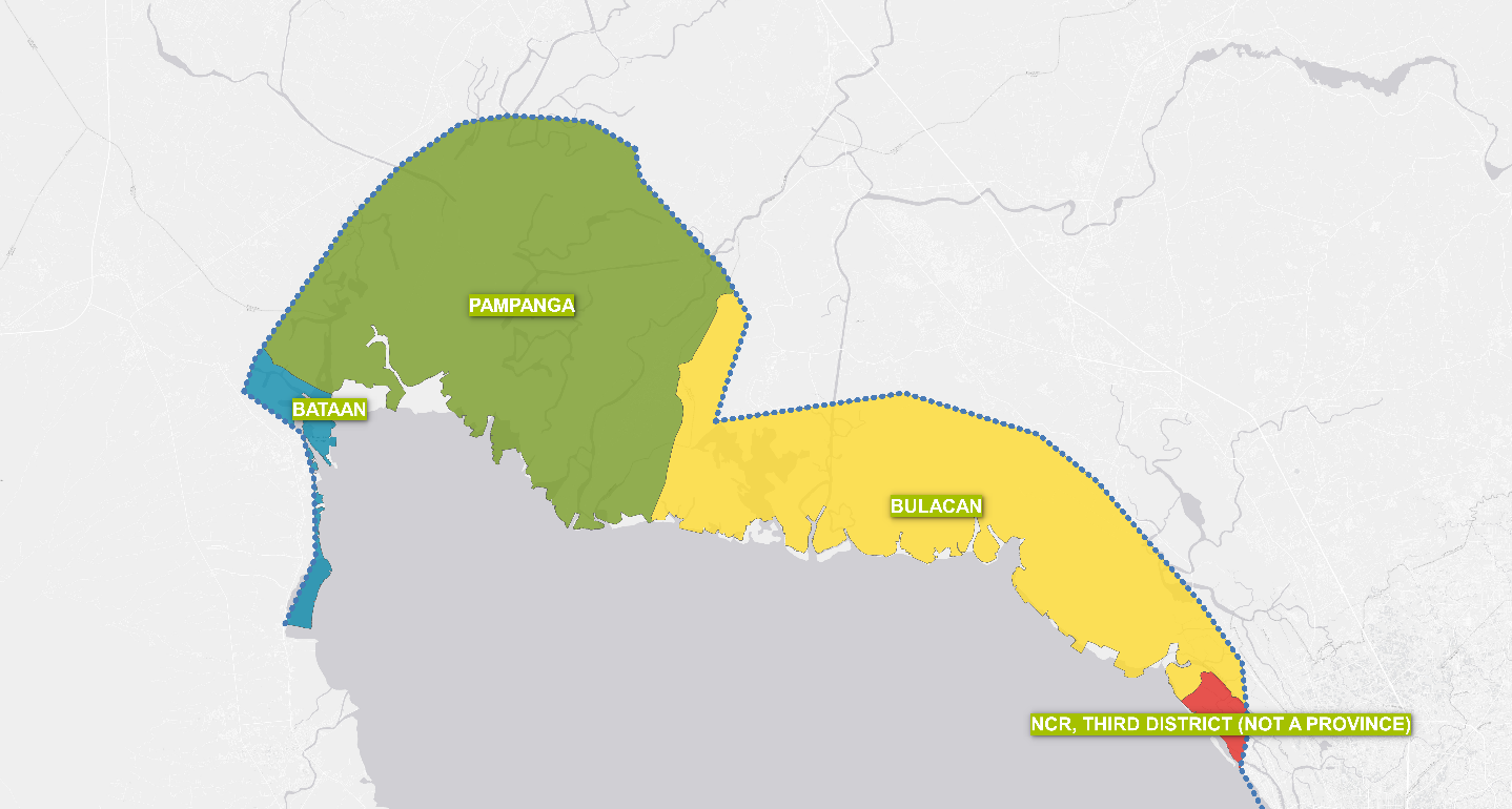
Step 3: Provinces
The scope of the North Manila Bay Flood Protection Strategy is limited to the Provinces of Pampanga and Bulacan. The Coastal Line of Defence also impacts Bataan and NCR Third District, but these were excluded from the scope of this strategy.
Step 4: Population centres in or inside CLD
The following LGUs within the Provinces of Bulacan and Pampanga are crossed by the Coastal Line of Defense and are adjacent to the coastline:
Bulacan | Population Centres (Barangays) |
|---|---|
Bulacan | Bambang |
Malolos | Pamarawan |
Paombong | Binakod, Masukol, Santa Cruz |
Hagonoy | Pugad, Sagrada Familia, San Pablo, Tibaguin |
Pampanga | |
|---|---|
Masantol | Bagang, Balibago, Bebe Anac, Bebe Matua, Bulacus, San Agustin (Caingin), Santa Monica (Caingin), Cambasi, Malauli, Nigui, Palimpe, Puti, Sagrada (Tibagin), San Isidro Anac, San Pedro, Santa Cruz, Santa Lucia Wakas, Sapang Kawayan, Sua |
Macabebe | Consuelo, San Esteban, and Dalayap |
Sasmuan | Batang 1st, Batang 2nd, Mabuanbuan, Malusac, San Antonio, San Pedro, Sabitanan |
Lubao | Bancal Sinubli, Bancal Pugad, San Jose Gumi, Santa Teresa 2nd |
Population centres are defined below:
As mentioned in step 1, the flood protection strategy will be focused on the population centres located between the Coastal Line of Defence and the current coastline to provide safety for the people who live there. Population centres along or inside the CLD are defined as a group of priority locations.
Step 5: Population outside CLD
The Manila Bay Sustainable Development Masterplan proposes to protect the current population centres along and inside the Coastline of Defence. For the population centres outside of the CLD it is acknowledged that for the bigger population centres (such as Macabebe), it is not feasible to relocate the whole population centre in the near future. Therefore, population centres outside but along the CLD are defined as a group of priority locations. In line with the Manila Bay Sustainable Development Masterplan the aim is to motivate inhabitants to move/relocate more inland, as due to sea-level rise and land subsidence, the area is not suited and sustainable for further urban development. New infrastructure developments will need to be discouraged while nature-based flood protection will be provided following the principles for the restoration of the coastal intertidal system, this will provide short-term solutions for inhabitants living in these areas. Nature-based Solutions will be focussed on measures that have a direct positive effect on the safety, livelihoods and sustainability of the living environment (ecosystems, natural resources and biodiversity) as these are interconnected. Implementing these solutions will benefit the resilience of the inhabitants of these areas who usually belong to the most vulnerable population groups.
Step 6: Livelihood and Infrastructure
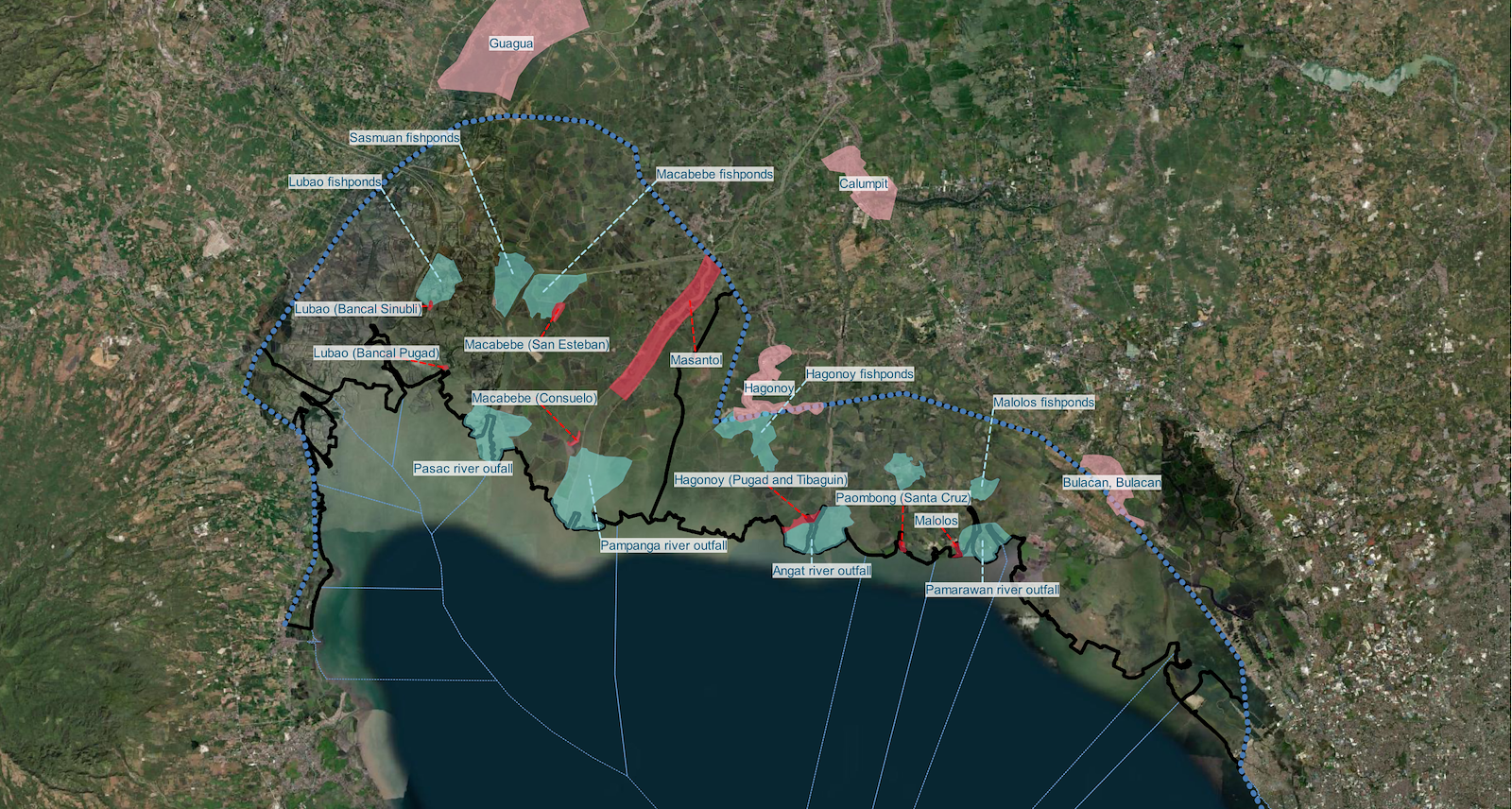
This step is intended to determine the primary form of livelihood and infrastructure within the North Manila Bay project scope. This will be beneficial for assessing the appropriate flood protection strategy that will complement not only their primary source of living but also the existing major structures in the community. For example, mangrove belts can be applied in backshore fishponds, while inland earth dikes protect urban infrastructure. Table below summarises the identified livelihood and infrastructures per municipality.
Primary livelihood and infrastructures for each key location
Province | Municipality | Livelihood/Infrastructure | |
|---|---|---|---|
Pampanga | Macabebe | Pampanga river outfall (Macabebe road) | |
Bulacan | Hagonoy | Angat river outfall | |
Pampanga | Sasmuan | Pasac river outfall | |
Bulacan | Malolos | Paramaran river outfall | |
Pampanga | Macabebe | Macabebe fishponds | |
Bulacan | Hagonoy | Hagonoy fishponds | |
Pampanga | Lubao | Lubao fishponds | |
Pampanga | Sasmuan | Sasmuan fishponds | |
Bulacan | Paombong | Paombong fishponds | |
Bulacan | Malolos | Malolos fishponds | |
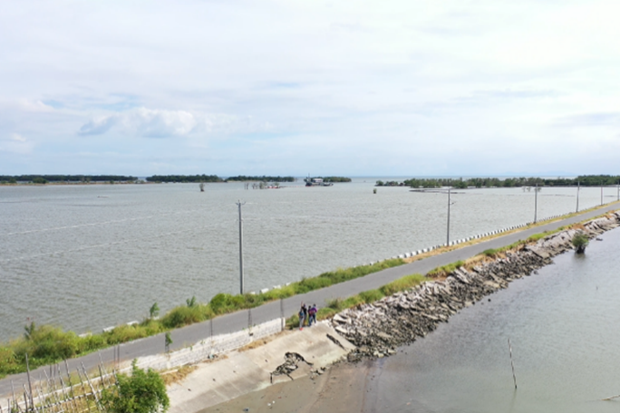
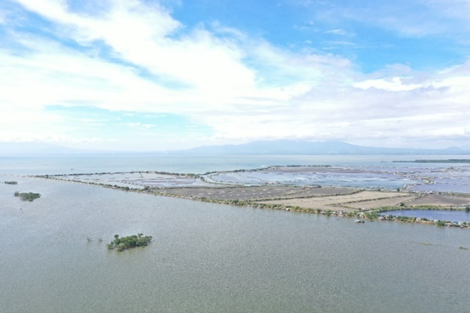
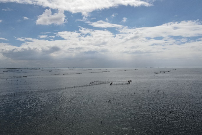
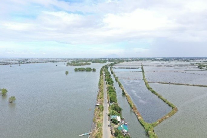
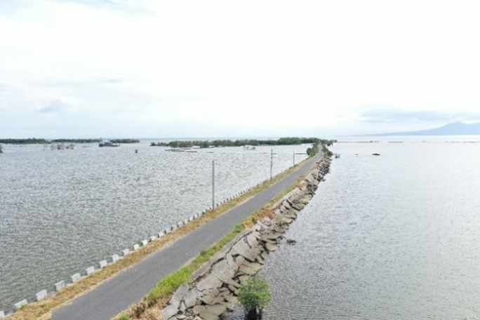
Site Visit Snapshots
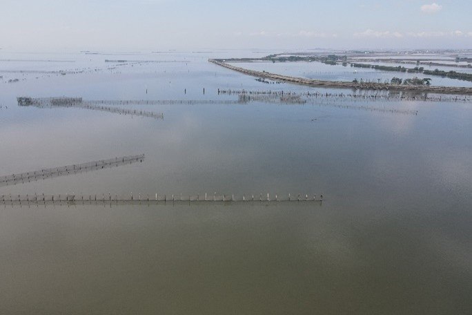
River outfalls in Macabebe (Pampanga), Hagonoy (Bulacan), and Sasmuan (Pampanga)
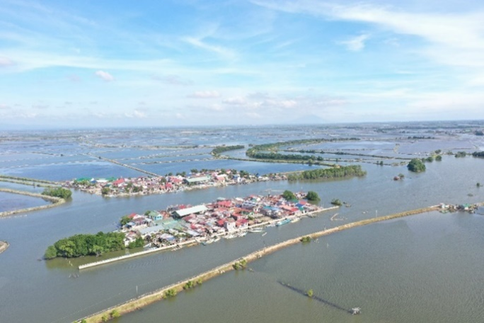
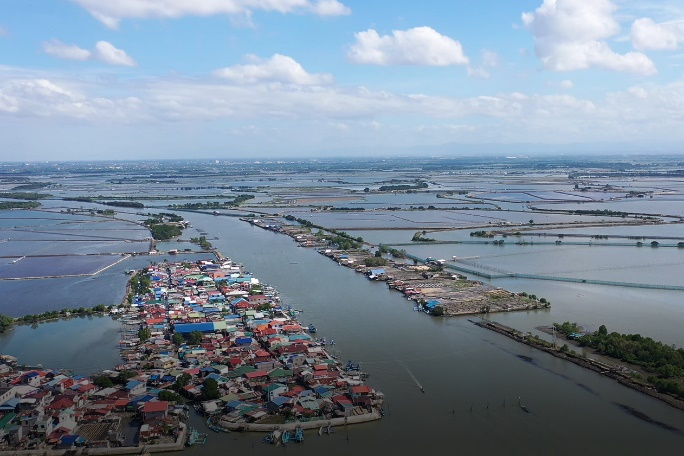
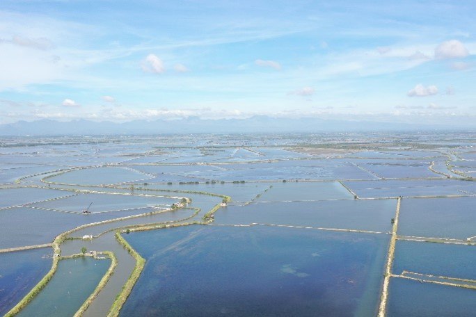
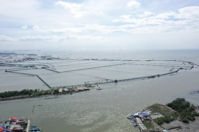
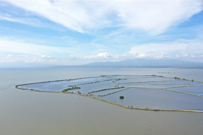
Fishponds in Macabebe (Pampanga), Hagonoy (Bulacan), Lubao (Pampanga), Sasmuan (Pampanga), Paombong (Bulacan), Malolos (Bulacan)
Roads in Barangay Consuelo, Macabebe, Pampanga (West & East)
Infrastructure and livelihood locations are defined as a group of priority locations.
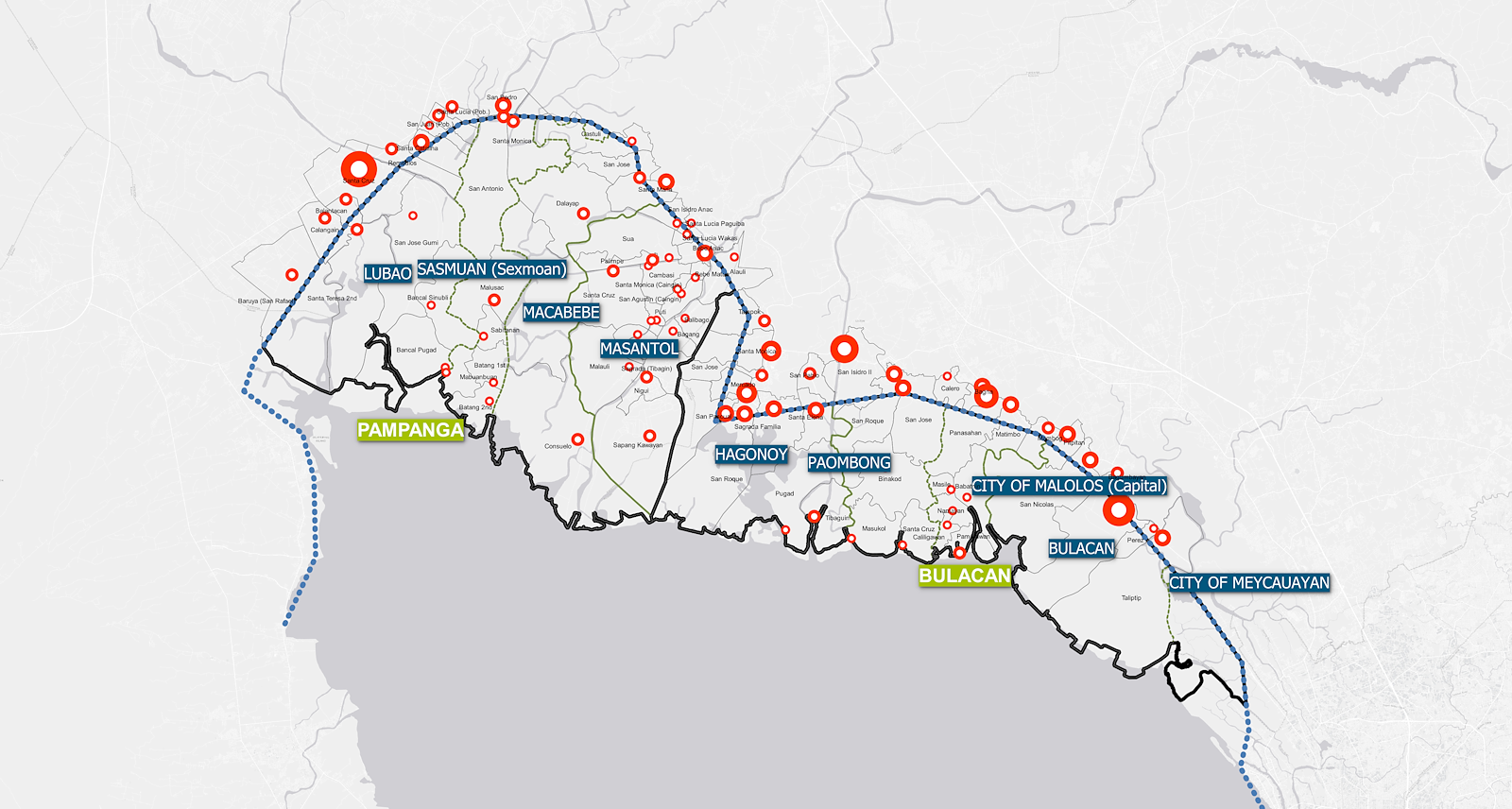
Priority locations
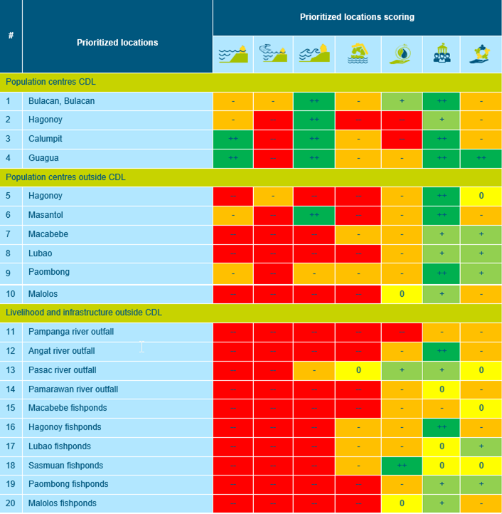
The described location assessment process leads to 20 priority locations. Appendix 6 shows a detailed map of all priority locations, while Appendix 5 includes a detailed risk analysis per location. The figure below shows a snapshot of the maps included in the appendices.
The overview of these assessments is given in the table below. It has to be noted that the assessment of these locations is a combination of existing data, site surveys, and expert judgement by Royal HaskoningDHV and associated experts. The assessment may be different if a specific area within the location will be assessed or the other way around if the bigger area is considered. The purpose of this assessment is to reach an optimal flood protection strategy for the North Manila Bay area. The scoring is based on the description as set out in Appendix 5, as the general application of Nature-based Solutions is very dependent on local characteristics and a systemic approach; the scoring should be seen as first indicator. Any applications of Nature-based Solutions should be based on further design efforts.
Prioritized locations assessment overview