Storm surges
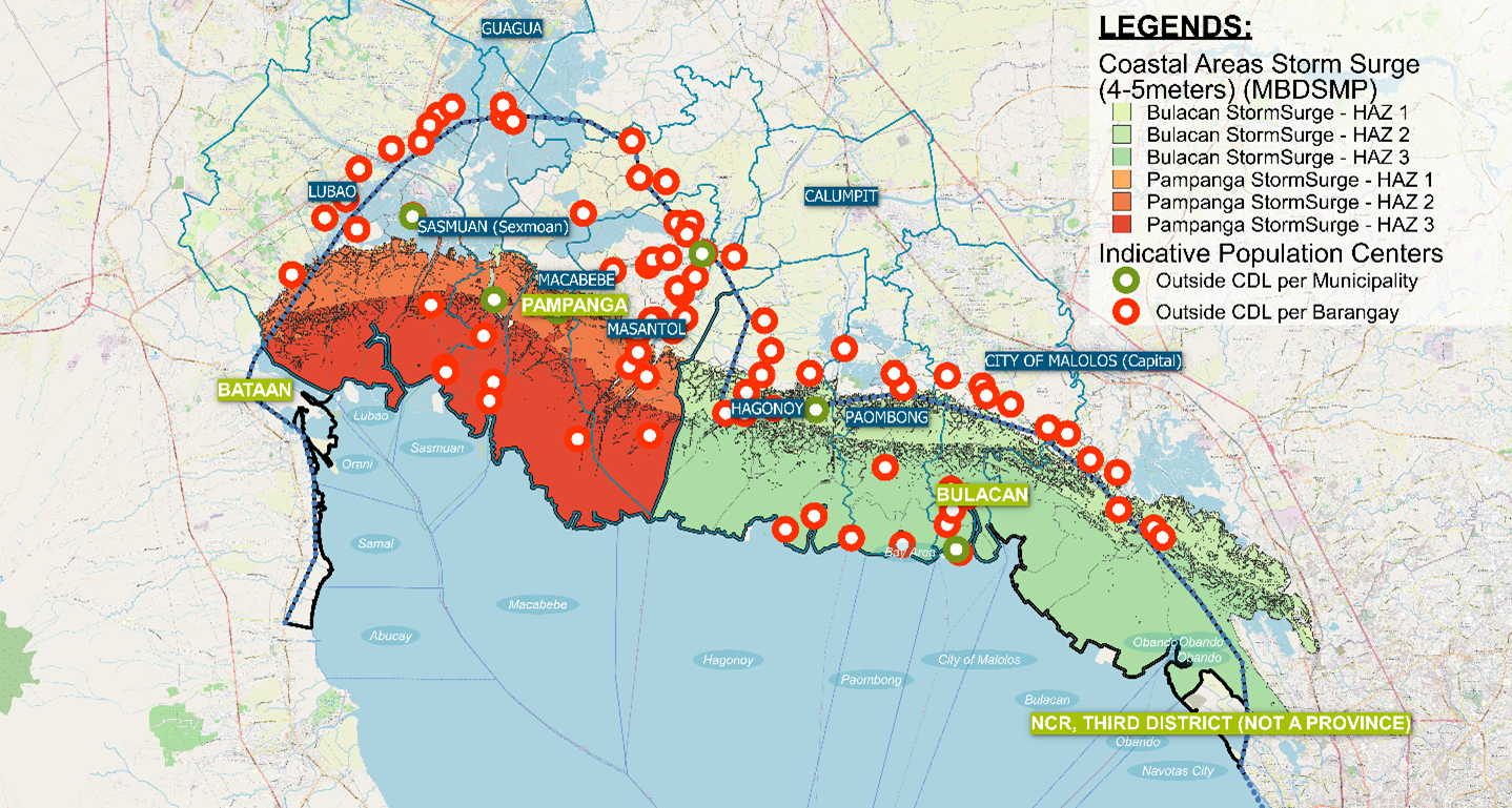
The layout of Manila Bay makes North Manila Bay Delta vulnerable to flooding due to storm surges during southwest wind directions [22] [23]. Studies on hindcast data show that water level elevations (storm surges) [22] could reach 2 meters MSL. However, it must be noted that all existing studies mainly focus on the Metro Manila area. Due to the layout of Manila Bay, it is expected that the storm surge can be higher when it reaches the coast under certain circumstances. With an expert judgment (based on various sources) on the extrapolation of the surge data, it is assumed that there is a significant chance that in the coming 100 years a storm surge of 3 to 4 m MSL could impact the area. This excludes additional set-up due to river discharge. The figure below shows the impact of such a surge. Surges like this will dominate the flooding of the area.
Such large storm surges have an enormous impact on the management of the coastal area. Typhoon Pedring in 2011 caused a storm surge of about 1.8 meters above the prevailing tide and reached tenths of kilometres inland in combination with high river discharges. It took months before the water drained out of the areas back to the sea. Local structures to protect fishponds and/or coastal communities were completely destroyed. Most fishpond owners, communities and local government did not have the means to restore what was there. In several places, the coastline retreated for hundreds of meters. Most of the area of the current NMIA was converted from land to sea.