North Manila Bay Delta characteristics
The study area of this flood protection strategy, the North Manila Bay Delta, consists of the downstream part of the rivers of the Pampanga River Basin, including the coastal area.
The area is a large alluvial plain with coastal wetlands downstream. The wider Pampanga River Basin has a catchment area of 10,000 km2 [9]. The Pampanga River Basin can be roughly divided into three river systems:
-
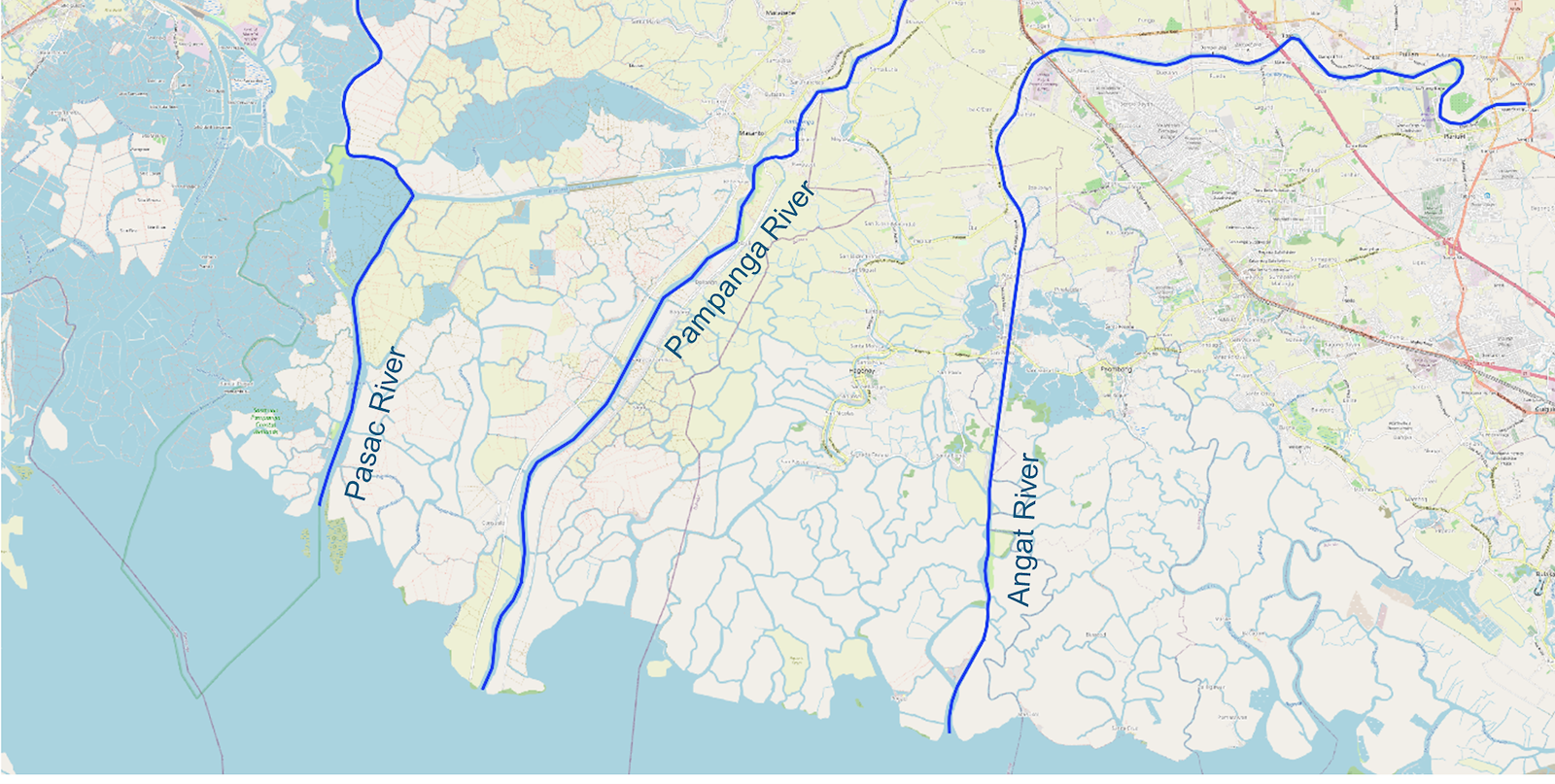
The Pampanga main river system has a basin of approximately 8,000 km2. The river originates from the Caraballo Mountains and empties into Manila Bay.
-
The Angat River system has a length of 165 km and a catchment area of approximately 1,085 km2. The river originates from the Sierra Madre Mountains and empties into Manila Bay through the Labangan Floodway.
-
The rivers in the Pasac river system originate from Mt. Pinatubo and flow into Manila Bay. The river system is connected to the Pampanga River by the Bebe-San Esteban Cut-off Channel. The total catchment area of the river system is about 1,371 km2.
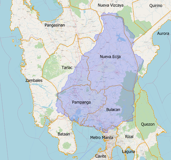
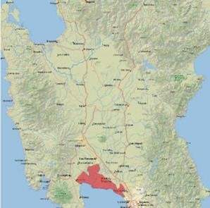
The Pampanga river basin (left, blue) [9] and the Pampanga Delta (right, red)
Near the river outflows, the coastal wetland areas are 0-1 meters above MSL and reach several kilometres inland. The upper parts of the delta are about 9 meters above MSL. Due to this relatively small elevation difference over the extent of the delta (20-30 kilometres), the North Manila Bay Delta is prone to pluvial (rainfall), fluvial (river), and coastal flooding. Decades of coastline expansion, sea-level rise, river flow narrowing, and rapid land subsidence in recent decades make the North Manila Bay Delta area even more vulnerable to flooding. This flood protection strategy will provide an approach to mitigate the fluvial and coastal flooding impacts in parts of the North Manila Bay Delta. It will also provide a basis for expanding the strategy towards other areas and solutions.
The North Manilla Bay Delta coast is tide-dominated, with some river-dominated features at the mouth of the Pampanga River. The tide is mixed, predominantly diurnal (one high and one low tide each lunar day), with an average tidal range of 1.2 m during spring and 0.4 m during neap tide [11]. Wind can also cause an increase in water levels in the bay. During the southwest monsoon (June-September), the tidal amplitude can be increased by 80% in the area. Furthermore, wind waves of over 3 meters may occur [12]. Tsunamis in the Philippines could be devastating, although only one has occurred in Manila Bay in the last 100 years. The relative sea-level rise rate in Manila Bay is on average 1.5 cm to 2.5 cm per year. In addition, the land is sinking in several areas; the land subsidence is caused by groundwater over-extraction [13].
The dry season runs from December to May and has average monthly precipitation in this area between 30 to 160 mm [11]. The wet season runs from June to November, and the average monthly rainfall ranges from 180 mm to 410 mm. Tropical cyclones with storms mostly occur during the wet season. Manila Bay is susceptible to storm surges; on average, the study area is affected by one to two storm surges per year related to cyclones [14]. At the peak of the cyclone period, rainfall can be up to 400 mm a day.
The substrate in Manila Bay ranges from mud to sand. The sediment is muddier near the river mouths, supplied by the rivers [15].
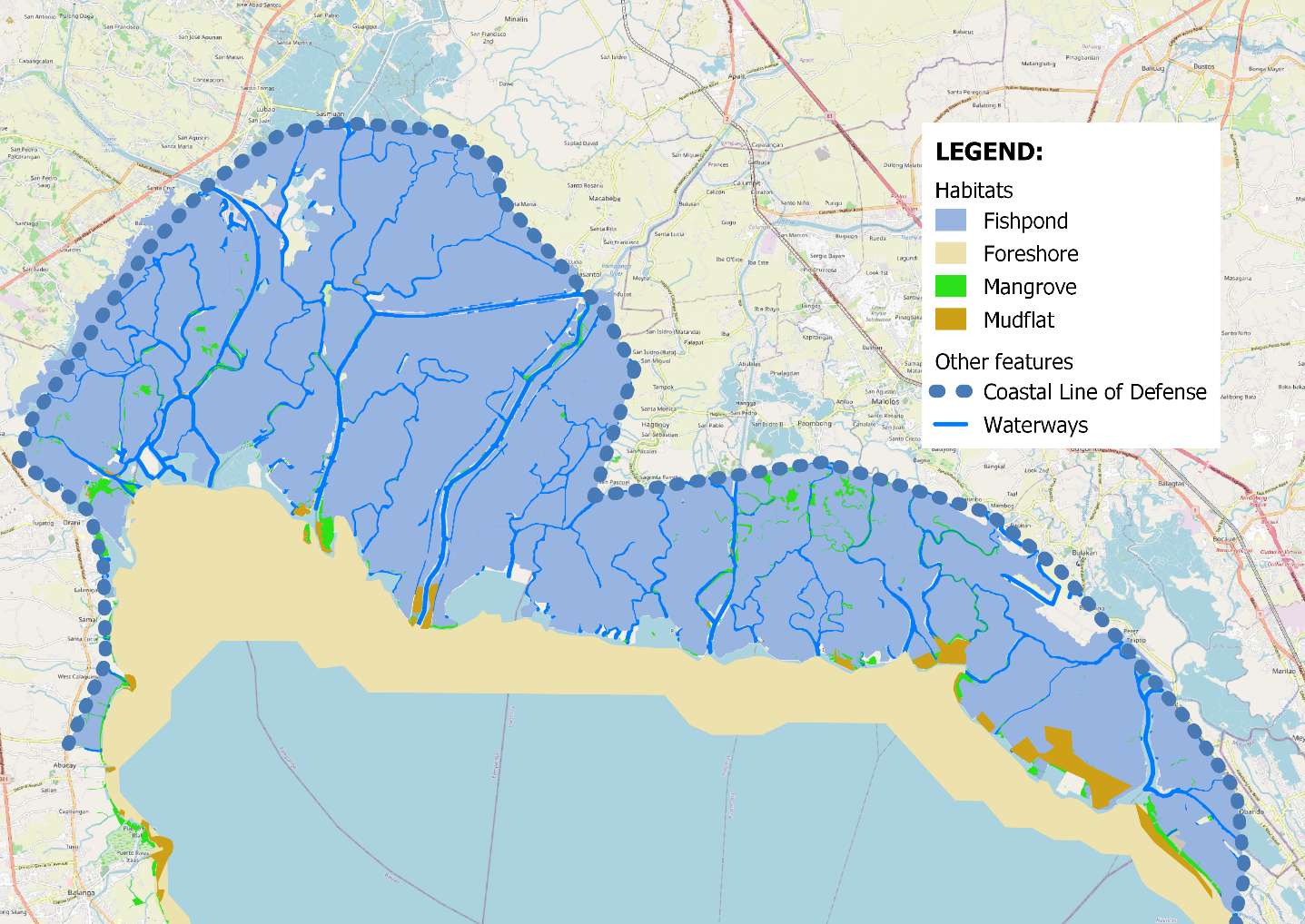
The four main wetland habitats in the North Manila Bay Delta coastal zone are fishponds, shallow foreshores, tidal flats, and mangroves (figure below). Wetland habitats decreased by 71% over around 125 years [16]. Fishponds (61.271 ha) were initially constructed in former mangrove areas but had been expanding into the shallow bay waters, mudflats and rivers [17]. In the 1970s, mangroves were converted to rice paddies, and since 1996 most of these rice paddies have been converted into fishponds due to extending saltwater intrusion caused by subsidence and rising sea levels. The fishpond expansion in the Pampanga Delta, about 15,000 hectares, took place over the past 40 years.
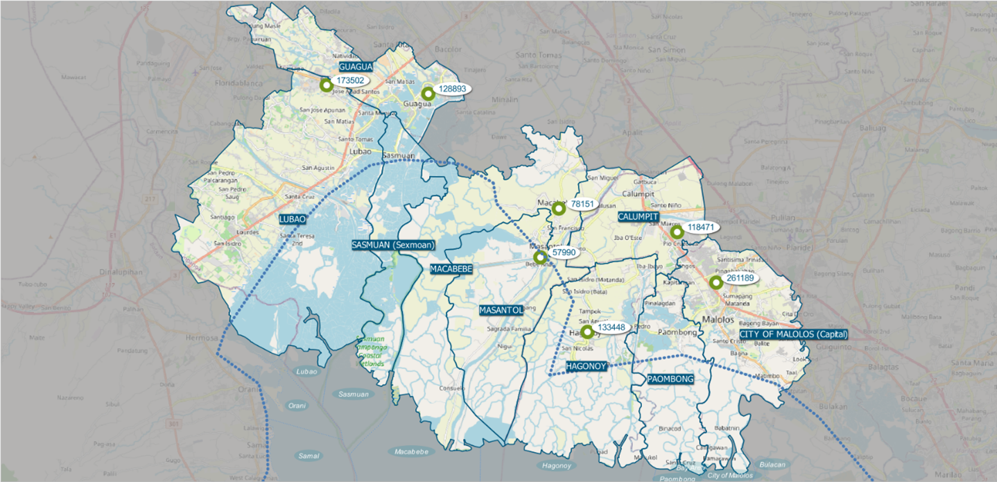
Major population centres are:
-
BulacaN
The municipality of Bulacan lies in the southwestern part of the province of Bulacan. It has about 80,000 inhabitants and will be adjacent to the New Manila International Airport development. Due to the proximity of the airport development, it is expected that the characteristics of the area will change rapidly in the coming years. Therefore, Bulacan as a population centre is not included as a “priority location” in this flood protection strategy. -
Malolos
Malolos is the capital city of the province of Bulacan. As such, the city hosts many provincial government offices. The city is home to more than 260,000 inhabitants, most of which reside in the urban areas in the northern part of the city. Meanwhile, the southern part of the city is situated near the coastline and predominantly consists of fishponds and intertidal areas.. -
Calumpit
The municipality of Calumpit is part of Bulacan province and lies along the border with Pampanga. It has a population of more than 118,000. It is a landlocked municipality and lies more than 10 km from the coastline of North Manila Bay. Thus, it is not considered a major priority location. However, it lies along major rivers, including the Pampanga River and Angat River, making the area prone to river flooding -
Hagonoy
The coastal municipality of Hagonoy lies at the southwest corner of the province of Bulacan, south of Calumpit. It has more than 133,000 inhabitants, most of which reside in the northern part of the municipality. A few smaller population centres are situated along Manila Bay. -
Masantol
Masantol is one of the municipalities at the southern end of Pampanga. It has a population of about 58,000. Population centres are primarily situated in three locations: the northeast corner of the municipality, along the stretch of Pampanga River, and the Bebe-Esteban Cutoff Channel. -
Macabebe
The municipality of Macabebe has a population of more than 78,000. The northern part is home to most of the residents. Meanwhile, the southern part is largely occupied by fishponds which are major source of livelihood for the residents. -
Guagua
The municipality of Guagua does not lie along Manila Bay as it is more than 15 km from the coastline. It has about 129,0000 inhabitants. The main population centre lies at the western part of Guagua while the remaining residential areas are scattered throughout the municipality. Farm fields occupy a larger portion of Guagua while fishponds occupy a smaller area. -
Lubao
Lubao is one of the largest municipalities in Pampanga in terms of area. It has a population of more than 173,000. Most inhabitants reside at the northern part of Lubao which is farther from the coastline. The southern part of Lubao consists mainly of fishponds. A few villages are also situated near the coastline.