Sediment extraction
The Philippines is a rapidly developing country, and the need for building materials is higher than ever. Due to the increasing demand for building materials, quarry permits and concessions are highly sought. In addition, new policies now allow for large-scale commercialised sediment dredging of rivers and river mouths that disrupt the natural build-up of new coastal lands and risk causing further erosion in the study area, see Section 2.4.4.
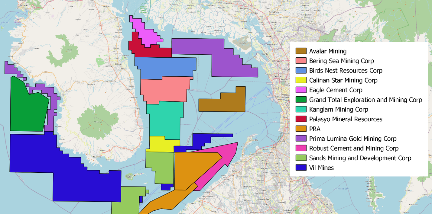
The figure above shows several mining concessions close to the North Manila Bay Delta coastline. These concessions entail the extraction of marine sand, aggregates and other minerals. It is not clear when the concessions will be activated. But when these areas are mined, the seabed will transform (will become deeper), leading to a disturbance of the current morphological layout of the North Manila Bay Delta. Impacts could be:
-
Increased wave heights due to the deeper seabed, leading to increased erosion;
-
Increased erosion due to soft sediments flowing into the deeper dredged areas;
-
Higher surge levels, increasing flood levels;
-
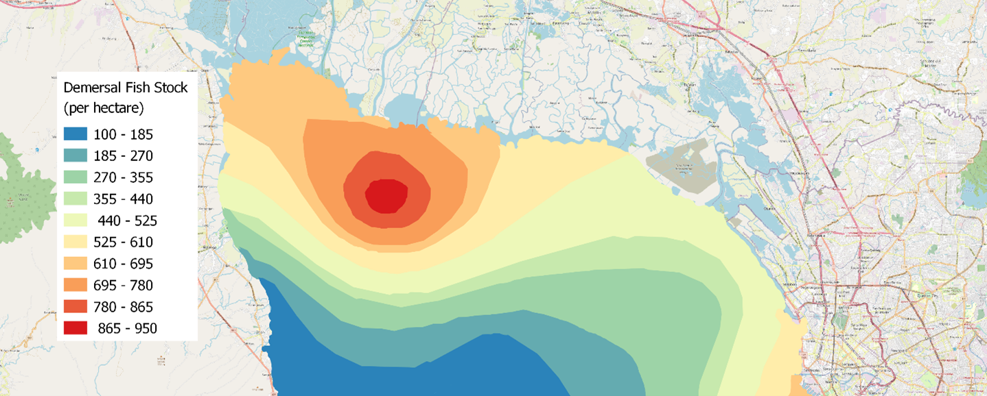
Impact on livelihood and nature, for example, the fish stock, see figure below.
Furthermore, it is known that dredging permits for the Angat, Pamarawan, Malolos and Bulacan rivers have been issued. At this point, no ECC/EIS documents have been shared by DENR EMB, MGB or local LGUs. Improper dredging of these rivers could lead to adverse effects. Various sources also confirmed that there is a mining concession between the current coastline and the Prima Lumnia concession, as shown in the first figure. At this point in time, DENR MGB could not confirm whether these permits had been issued by MGB or local LGUs.