Multi Criteria Analysis
For this project, a multi criteria analysis (MCA) has been utilized to understand the hazards, risks, and social dimensions associated with the pilot locations. The scoring mechanism is based on eight key criteria items including:
-
Coastal flooding reduction;
-
River flooding reduction;
-
Erosion prevention;
-
Damage prevention;
-
Social impact;
-
Institutional complexity;
-
Environmental impact; and
-
Technical feasibility.
The figure below shows the legend of the degrees of impact and feasibility of NbS on shortlisted areas in the City of Malolos.
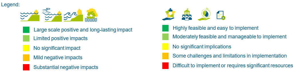
The degrees of feasibility, which refers to the level of applicability of NbS in the pilot locations, were qualitatively measured based on expert judgement for the criteria items above. The degrees of technical feasibility mainly tackles about understanding of footprint, availability of materials, costs, and local knowledge. For the social impact criteria item, the target locations were assessed based on the intended number of beneficiaries, sustainability, and negative effects of removal/replacement of settlements to create space.
For the environmental impact, the main concern focused on how the proposed site locations can accommodate the solutions to fit the natural system. It is centred on the following parameters: (i) sustainable coastal intertidal system; (ii) sustainable ecosystem with respect to biodiversity; (iii) healthy living environment for the population; and (iv) reduction in greenhouse gases. Lastly, the institutional complexity refers to the complexity to implement, enforce, and create an impact with the measures. This is in relation to the NbS options to be implemented locally with significant positive impact.
The MCA was finalized after a series of further site-specific evaluations and focused group discussions with relevant stakeholders. During this process, it became apparent that Brgy. Panasahan has the potential to serve as a pilot location, especially considering its strategic location as the main access point to the island of Pamarawan via the Panasahan port. Moreover, ongoing and planned flood protection developments by the DPWH along the Calero River also encompass barangays Atlag, Bagna, and Panasahan. As a result, barangay Panasahan was included in the MCA evaluation. The table below summarizes the perceived applicability of implementing NbS in the target locations:
Summary of Results based on the MCA for Target Location for Nature-based Solutions Implementation
ID | Proposed Pilot Location | Coastal Flooding Reduction | River Flooding Reduction | Erosion Prevention | Damage Prevention | Social Impact | Institutional Impact | Environmental Impact | Technical Feasibility |
 |  |  |  |  |  |  |  | ||
1 | Atlag | 0 | + | + | + | - | - | + | -- |
2 | Bagna | 0 | + | + | + | - | - | + | - |
3 | Santo Rosario | 0 | 0 | 0 | 0 | - | - | + | -- |
4 | Pamarawan | ++ | 0 | ++ | ++ | ++ | ++ | ++ | + |
5 | Panasahan | 0 | + | ++ | ++ | - | + | ++ | - |
Based on the qualitative expert judgment of the RHDHV team and the reaffirmation from household survey results and observations conducted, the sites were initially assessed whether a nature-based approach and such interventions can generally minimize the impacts of the predominant water-related hazards present in their locality. In particular, the following are the detailed bases for the scoring for the eight (8) criteria items:
-
For coastal flooding reduction, only barangay Pamarawan, an island barangay, experiences direct coastal flooding due to storm surges. Thus, such reality is seen to have potential to implement NbS options and have large scale positive and long-lasting impact for the community.
-
For river flooding reduction, the barangays that would mainly benefit from the NbS options to address fluvial flooding are Brgys. Atlag, Bagna, and Panasahan as these are the localities where the main waterways pass through.
-
For erosion prevention, the implementation of NbS options in Brgy. Pamarawan would be significant as it also constantly experiences erosive tidal forces. In addition, Brgy. Panasahan also had a high score as the river passing through the barangay is utilized for agricultural practices (e.g., saltpans and fishponds) with low-lying clay dikes as their sole protection from erosion.
-
For damage prevention, the scoring was derived from the results of the household surveys. The results show that the inland barangays (i.e., Brgy. Atlag, Bagna, and Santo Rosario) experience relatively lesser flood damages compared to the residents in Brgys. Pamarawan and Panasahan as these localities rely on non-structural flood protection measures (clay dikes) compared to these inland barangays.
-
For social impact, the scoring was based on the impact of implementing NbS options in the localities in relation to relocation of settlements and establishments vis-à-vis intended cost effectivity. With such premise, Brgy. Pamarawan is seen to accrue more positive impact over intended costs. On the other hand, It was observed however, that some challenges and limitations are more apparent in urban settlements in other barangays.
-
For the institutional complexity, the scoring was based on the potential of acquiring certain privately owned properties and lands for public utilization for related NbS options. Given this, Brgys. Pamarawan and Panasahan could yield more positive effects as compared to other urban localities given the existing settlements and establishments that may be needed to implement the NbS options.
-
For the environmental impact, all the sites garnered exceptional scores since the NbS interventions offer positive impacts towards biodiversity and the overall ecology in the localities, especially in Brgys. Pamarawan and Panasahan.
-
Lastly, in terms of technical feasibility, Brgys. Bagna and Panasahan would face some challenges and limitations in implementation due to river space considerations. On the other hand, the NbS interventions would be difficult to implement technically in Brgys. Atlag and Santo Rosario as they would require significant resources and retrofitting in an enclosed urban setting. The technical feasibility for each site is discussed in further detail the table below.
Overall, Brgys. Pamarawan and Panasahan garnered the highest positive degrees of impact and feasibility. They are followed by Brgys. Bagna and Atlag, which are urban barangays and with perceived lower degrees in terms of practicability especially for social, institutional, and technical feasibility. Lastly, the evaluation findings for Brgy. Santo Rosario indicated that implementing NbS interventions would yield least significant impacts and would pose substantial challenges for initiating a NbS options. As a result, Brgy. Santo Rosario has been excluded from further technical evaluations.
Further examination of the technical feasibility is provided in the succeeding sections to evaluate the suitability of the eight (8) shortlisted NbS within the four (4) barangays. The figure below illustrates the conceptual representation of these NbS options (e.g., enhanced breakwaters and green embankments), which are subsequently discussed in Section 6. These determinations are the result of expert assessments, on-site evaluations, as well as inputs from stakeholders and household surveys.

| 
|  Re-use of Dredged Materials |  Sediment Trapping |

|  Enhanced Breakwaters |  Foreshore Islands |  Green Embankments |
Identified Nature-based solutions options
The table below lists the technical requirements of each NbS option vis-à-vis the compatibility with the site-specific conditions per barangay. These criteria focus on the assessment of factors including: (a) footprint or required area of implementation; (b) costs of the development; (c) availability of materials; and (d) local knowledge.
The RHDHV team recognizes that each NbS intervention is assessed based on their applicability to be sufficiently implemented in the respective barangays. The criteria, however, should not be viewed as interdependent such that if footprint is limited or not applicable for a certain barangay, another solution will be considered.
In particular, footprint considerations, which aside from land availability, considered the natural channel of the rivers to minimize impacts on discharge capacity and navigability. Initial site assessments revealed that urban barangays showed limited to restricted available space for NbS options due to concerns of land ownership and narrowing of rivers from structural developments. Moreover, it was observed that drainage improvements would be more applicable and beneficial for the inland barangays as flooding is mainly induced by the backflow from high tides.
The assessment of development costs and material availability were evaluated primarily through expert judgment, complemented by existing pertinent standards and guidelines. Additionally, insights from the City Planning and Development Office and City Engineering office of the City LGU of Malolos were incorporated for better streamlining of available data and information on the ground. Lastly, local knowledge was also considered essential to facilitate the implementation of NbS interventions. As the introduction of NbS is a relatively new approach for the people, proper guidance and support may be needed for successful establishment and management of the pilots. For this criterion, the barangays were assessed based on the results of the household surveys and the presence of existing local practices or structures closely related to the principles of the shortlisted NbS options.
Technical Feasibility of Nature-based Solutions Options per Barangay
ID | Nature-based Solutions Option | Atlag | Bagna | Panasahan | Pamarawan | ||||||||||||||||
 |  |  |  | | | | | | | | | | | | | ||||||
1 | Vegetative Stabilization | ||||||||||||||||||||
2 | Riprap Stabilization | ||||||||||||||||||||
3 | Sediment Re-use | ||||||||||||||||||||
4 | Sediment Trapping | ||||||||||||||||||||
5 | Aquasilviculture | ||||||||||||||||||||
6 | Enhanced Breakwaters | ||||||||||||||||||||
7 | Foreshore Island | ||||||||||||||||||||
8 | Green Embankment | ||||||||||||||||||||
Next, the four (4) criteria items are used to the eight (8) NbS options, as follows:
-
Vegetative stabilization refers to the use of native plants and appropriate vegetation to prevent erosion and stabilize streambanks. The plant roots help bind the soil, reduce surface runoff, and enhance slope stability. It is a cost-effective option due to the availability of materials and lesser requirement of resources but is currently not practiced in the barangays. Also, in terms of footprint, this NbS option is seen to be least applicable in Brgys. Atlag and Bagna as these sites are already lined up with on-going concrete flood protection measures. Vegetative stabilization can also be incorporated in the clay dikes along Brgy. Panasahan, but may be limited by insufficient slopes. Brgy. Pamarawan, on the other hand, has enough space for its implementation.
-
Riprap stabilization, unlike vegetative stabilization, involves the use of rocks or stone materials to protect shorelines or riverbanks from erosion and is already a common practice in the country. The rocks are typically arranged in a layered or sloping manner to absorb the energy of the water, reduce erosion, and provide stability to the underlying soil. However, such intervention would require greater investments due to costs from sourcing and transporting the materials. In terms of footprint, the criteria results are seen to be similar to vegetative stabilization.
-
Sediment re-use, in NbS terms, refers to the practice of repurposing sediment or dredged material from water bodies for nature-based developments. Instead of disposing of the sediment in landfills, it can be used beneficially, such as for wetland restoration, beach nourishment, or flood protection embankments. This approach helps reduce sediment waste promoting ecological and economic benefits. The sites were assessed assuming that the materials are readily available as there are on-going river dredging works in the municipality. As for footprint, only Brgys. Pamarawan and Panasahan have available space for its application with special consideration on the Calero River passing through Brgy. Panasahan. Notably, the existing clay dikes established by the locals are made up of re-used dredged materials from the same river.
-
Sediment trapping involves the use of structures composed of indigenous materials (e.g., bamboo and brushwood) to capture and retain sediment that would otherwise be carried away by water currents. This NbS supports the replenishment of subsurface elements, fosters mangrove restoration, and mimics natural sedimentation processes, albeit in targeted priority areas only. It can be best implemented in Brgy. Pamarawan as it is a coastal barangay that constantly experiences erosion from tidal forces. The other barangays have no available space along the rivers especially in Atlag as it would require expensive retrofitting of existing structures.
-
Aquasilviculture is an NbS that combines aquaculture with mangrove reforestation. It involves integrating fish or shellfish farming with the cultivation of mangrove plantations. This approach provides multiple benefits, including water filtration, nutrient cycling, habitat creation, and potential livelihood opportunities for the residents. This is seen to be an optimal NbS for all the barangays given the nature of the livelihood in the communities and established local knowledge on mangrove planting. Aquasilviculture can provide a synergy of benefits to the city but is limited by the availability of land for appropriation. It is also worth noting that the City of Malolos was originally composed of extensive mangrove belts and mudflats but were unfortunately lost due to fishpond conversion and overall urban development.
-
Enhanced breakwaters are offshore structures designed to reduce wave energy and protect coastlines from erosion. Unlike traditional hard structures like concrete seawalls, enhanced breakwaters incorporate natural elements, such as oyster reefs to dissipate wave energy and promote shoreline stability if designed properly. This primarily applies to Brgy. Pamarawan, which is at the highest risk of storm surges due to its coastal location. Additionally, oyster production is already prevalent in the locality as observed in the site visits.
-
Foreshore islands, also known as offshore islands or artificial islands, are constructed in coastal areas as a nature-based solution to protect populated shorelines. These islands are built offshore and are designed to provide wave attenuation, reduce erosion, and create habitats for coastal species. Brgy. Pamarawan is once more most suitable for this pilot project due to the availability of space offshore. However, it would still take several years after implementation to fully establish environmental recovery and habitat development in the island. This does not align with the project’s targeted implementation within a two-year timeframe. Furthermore, foreshore islands require significant volumes of materials and resources which exceeds the capacity of a pilot project.
-
Green embankments involve the use of vegetation and re-used dredged materials to reinforce banks or slopes adjacent to water bodies. In addition, biodegradable geotextiles, such as coconets can be employed to promote the vegetation covers and improve overall slope stability, prevent erosion, and enhance the ecological value of the site. This NbS option is deemed advantageous for most of the barangays, except for Brgy. Atlag. In fact, Brgy. Atlag, implementation is unfeasible due to the ongoing flood protection measures by the DPWH and the already constricted state of the tributaries. A similar situation exists in Brgy. Bagna due to households encroaching upon the river. Nevertheless, a DPWH seawall is currently being constructed from the Brgy. Panasahan port extending to the built-up area of Brgy. Panasahan. Site visits revealed that the seawall is unfinished in the southern portion of the barangay and is seen as a potential site for the green embankment to close the gap and complement the existing structure with a nature-based solution. Notably, DPWH plans to extend the seawall northward to Bagna creating overlapping areas of interest. On the other hand, Brgy. Pamarawan has an extensive available footprint for the establishment of a green embankment. Also, its potential implementation was confirmed to be in alignment with the San Miguel Corporation Biodiversity Offset Program focused more on accommodating displaced migratory birds through mudflat restoration.
Overall, Brgy. Pamarawan stands out as the most technically feasible location for pilot implementation when compared to other prospective sites. Potential NbS interventions in this barangay include sediment trapping, aquasilviculture/mangrove reforestation, enhanced breakwaters, and green embankments. Brgys. Panasahan and Bagna remain as potential locations as per the MCA, while advocated by their respective LGU representatives, may face certain implementation challenges and constraints. In these two (2) barangays, the application of green embankments can be considered, primarily designed to complement existing flood protection structures. The details on specific pilot locations are discussed in the following section.